On the first day of Christmas- Make sure you keep it safe!
Marshalswick South Focus Team
Councillors, Rod Perks and Allan Witherick working with Andrew Duff MEP and Melvyn Teare for you Learn more
Highways - the hidden holes
Working for your safety, both here and abroad
On the first day of Christmas- Make sure you keep it safe!
Highways - the hidden holes
Working for your safety, both here and abroad
Coloured Bus? Actually- they are!
by awitherick on 14 January, 2012
You may have noticed a change towards the end of last year with a new colour-coded map providing simple, clear and understandable information for both new and existing bus passengers. The map, which has been produced by the Network St Albans partnership, covers the city’s ‘Pinks’ bus network and uses colour-coded routes to help bus users find their way around the new integrated network.
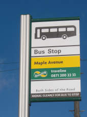
Liberal Democrats helped make this so you could stop the bus both sides of the road.
The ‘Pinks’ bus network was launched earlier in the year by Network St Albans, a local transport partnership which brings together the key transport providers in the district and was started up during the Liberal Democrat administration. Made up of organisations including local bus and train operators, St Albans City and District Council, Hertfordshire County Council and the University of Hertfordshire, Network St Albans aims to provide public transport that is comfortable, inviting, convenient and easy to use.
People have said that the lack of information was a barrier to using public transport and that they didn’t use the bus because they didn’t know where it went. This new map will go some way to addressing this problem and aims to encourage more people to choose to travel by bus. This map is just one of a series of major improvements to public transport in St Albans in the coming months.
Network St Albans is working on other measures to improve public transport journeys including the introduction of a multi-operator ticket. The enhancements in the town through Network St Albans are in conjunction with a range of county-wide developments by Intalink, which include stop-specific timetables, real-time information and the recent launch of a mobile phone App for bus travel.
There are also plans to introduce further maps for individual bus routes that include named stops and for the key interchanges at St Peter’s Street and the City Station.
You can link directly to it at: http://www.intalink.org.uk/Maps/NSA_Map.pdf
Leave a comment
Leave a Reply